Friday, October 7, 2022

Selfie 1,000 - Timothy TN to Masterson TX

Timothy is an unincorporated community in Overton County, at the eastern edge of Tennessee.  Mastersonis an unincorporated community in southern Moore County, in the Texas Panhandle, just north of Amarillo.

What a great opportunity for an Iron Butt Association "Selfie" SaddleSore 1,000!  Ride over 1,000 miles, under 24 hours from Timothy to Masterson.  The actual milage is almost 1,100 miles, since I'm starting the Selfie 1K from Celina TN, just northeast of Timothy and in Dumas TX, just north of Masterson.  Neither Timothy nor Masterson have DBR opportunities.

SpotWalla Map

I will be riding the Selfie 1K while fasting.  No stopping to eat nor snacking along the way.  Just coffee in the morning and drinking water. For the last 3 years I have been OMAD, eating only One Meal A Day, especially when riding.  Far more efficient than dealing with food driven behaviors while riding.  I normally fast each weekend, Saturday to Monday, for 48 hours. Since I am riding all day Saturday, I started my 48 hour fast on Friday. Had a great tasting pre-ride meal at the Mexican eatery across the street from my hotel in Celina.  Veggie fajitas with a side of bean burritos, chips and salsa, yummy!


Garmin zumo XT ride pace data: Celina TN to Dumas TX  

  • Miles -  GPS, 1,095.4 MC Odo 1,089
  • Timothy TN > 1,072 miles > Masterson TX
  • DBR Start: 04:48, 10/8/22 CDT
  • DBR Finish: 20:29, 10/8/22 CDT
  • Total Time: 16:19
  • Moving Time: 15:15
  • Stop Time:  0:56
  • Moving Avg:  74 MPH
  • Overall Avg:  67 MPH


RIDECRAFT
:  The collection of knowledge, skills and abilities used by a long distance motorcycle rider to maintain a consistent ride pace, manage risk and achieve navigational objectives.


Sunday, January 16, 2022

Ride Around Louisiana - "RALa"

The Ride Around Louisiana - RALa has been added to the growing portfolio of IBA In-State
Rides
 and the In-State Awards Program.  

Congratulations to Nathan Stueber, IBA 69272 for completing the first general membership certification of the Ride Around Louisiana.  

Dr. Howard Entman, my long time LD mentor, and I completed the validation and evaluation of the ride protocols Thursday-Friday, Jan 13-14. We rode to evaluated the level of effort necessary to safely and successfully complete the 1,220 miles of the Ride Around Louisiana.  This validated the route close to the border, mandatory stops, establishing 30 hours for regular and 24 hours for Gold certification.

We started and finished our RALa in Slidell, going in a anti-clockwise route.  We planned the route using Garmin BaseCamp, adding dwell time at each anticipated stop, to get an idea of the total time required.  A couple of the locations we used for our evaluation ride were changed for the final list.  See the RALa link above for the final list of mandatory stops.  As you can see from the BaseCamp route properties, it was going to be a long ride:  1,220 miles, 21:40 riding and 22:55 total time.

RALa GPX


At the start in Slidell, I zeroed out the GPS trip data to get an accurate total miles, riding, stopped and total route time.  We did not stop for meals along the way.  Howard ate out of his tank bag and I fasted the entire trip.  Below is the snapshot of my GarminXT at the finish back at the Slidell starting point.  As you can see, we did a pretty good job maintaining a consistent ride pace vs the BaseCamp route.  

  • Miles - 1,233.7 GPS, 1.224 MC Odo 
  • DBR Start: 06:07, 1/13
  • DBR Finish: 4:48, 1/14
  • Total Time: 22:41
  • Moving Time: 20:18
  • Stop Time:  2:23
  • Moving Avg: 60.8 MPH
  • Overall Avg: 54:4 MPH 

Not bad for a couple guys in their 70s.

We were both using SpotWalla to record our track.  I took required Start/Finish DBR & Odometer pictures.  I was using Bubbler GPS Pro.  I posted the Start/Finish DBR/Odo pictures to the SpotWalla route.  I also did a Bubbler "OK" at each of the mandatory locations along the route.  I added the odometer reading to the "OK" markers, but only the "Gas" markers recorded the odometer mileage in the remarks of the SpotWalla location marker.  Below is my SpotWalla track of our Ride Around Louisiana.

Ride Around Louisiana - SpotWalla Map


Start and Finish DBR/Odo pictures:


Thursday, December 16, 2021

GS Adventure TPMS Sensor Replacement

The rear Tire Pressure Monitoring System(TPMS) sensor on my 2016 BMW R1200GS Adventure was becoming intermittent.  On my way back from the annual Pink's Bite the Weenie event the TPMS yellow warning light would come on.  Pressure reading for the front was normal but the rear was blank.  I suspect the OEM battery was wearing out, causing it to go offline intermittently.

The options are purchase a new BMW OEM sensor at cost of around $275.00.  Or, remove the BMW OEM sensor and replace the battery embedded behind melted plastic. The option I selected was to replace the rear TPMS with an aftermarket version available on Amazon at 2 AUTOKAY TPMS sensors for $37.00. 

I did some research on YouTube on registering new TPMS sensors to the GS computer.  In addition to the TPMS sensor I also need a sensor "wake up" tool.  I purchased that on Amazon also:  VXSCAN TPMS Relearn Tool El50448 Auto Tire Pressure Monitor Sensor Reset OEC-T5 for $14.00.  By the way, the VXSCAN can also be used to "wake up" the GSA TPMS before riding, like using a tire pressure gauge. This can be very convenient, so I'll be carrying it with me.

Here's a picture of the OEM sensor, bottom, the new aftermarket sensor, top and the "wake up" tool.

I have the HEX GS-911 device.  It's a very handy tool to use with the GS to examine the fault codes, reset the "Service" due/date and many other GS related items.  

One of the functions available on the GS-911 software is to teach the GS computer to "Learn" the TPMS sensor ID.  Here's the YouTube video I used to register the new TPMS sensor to the rear wheel.  

Following the procedure in the video was straight forward and easy.  "Registering" the new rear wheel TPMS sensor worked the first time.


Here is a picture of the rear tire pressure after I taught the GSA TPMS to recognize the new sensor. I added some air to the rear tire to check for a change.  Looks pretty accurate to me!  What remains is a test ride to establish the rear sensor "waking up" under normal riding conditions.  


Monday, November 15, 2021

Ride Around Texas - Rewind

The challenge of the Iron Butt Association's iconic Ride Around Texas - RAT has been doubled!

After the highest turnout for the 2021 Ride Around Texas, RAT, at the Big As Texas "Ride-a-Palooza" last October, I got the idea to create the RAT version of the 100ccc.  Two consecutive RATs, one in each direction, Clockwise then "Rewind" Anti-Clockwise.

I proposed the idea to Dr. Howard Entman, Director of Operations at the IBA Institute for Ride Development (LOL) and Mike Kneebone, President of the IBA.  Howard said, "Why not?!"  It was then on me to validate the certification protocols.  My hope is the Ride Around Texas Rewind becomes the template for all other "Ride Around" in the list of In-State portfolio of rides.  Example; Ride Around Alabama Rewind, Ride Around Arkansas Rewind, etc.

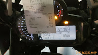
Below are the current rules for the RAT Rewind on the IBA Ride Around Texas page.  Based on my validation of the ride, I am making this recommendations.  Require the Start - Rewind - Finish be at the same DBR location.  This will ensure complete rotations each direction.  For example, I could have easily gotten a start DBR at a location next to the Galveston-Port Bolivar Ferry, and a finish DBR at the end of I-45, cutting the full rotation around Texas by several miles.  Making the Start/Rewind/Finish DBR from the same business is in keeping with the spirit of a complete Ride Around Texas.

Graphic work by Donna Fousek

RAT Rewind Objective Ride 2 consecutive rotations around the perimeter of Texas, one clockwise and one anti-clockwise, stopping at 18 mandatory checkpoints, including start/finish point, in order within the allotted time period for each rotation.  This is a back-to-back ride and follows typical back-to-back rules. 

     RAT Rewind - less than 85 hours each rotation (170 hour total)
     RAT Rewind Gold - less than 70 hours each rotation (140 hour total)

Note:  The Ending DBR date/time of the first rotation is the Start date/time of the second opposite rotation. For RAT Rewind each rotation must be less than 85 or 70 hours.  You can not carry over unused hours from one rotation to the opposite rotation.  For RAT Rewind GOLD each rotation must be under 70 hours.

I have split the entire ride into each of the rotations to make it easier to compare the Plan vs Actual RidePace.

Anti-Clockwise Rotation:  64:27, Odo 3,078, GPS 3,093.7

Clockwise Rotation:  67:33, Odo 3,092, GPS 3,093.9

RidePace
I rode just shy of 6,200 miles during the RAT Rewind GOLD in 5 days and 12 hours (132:00 / 24 hours = 5.5).

I did not use excessive speed during the RAT Rewind.  With many of the Texas highways 75 MPH there was no need to use excessive speeds to make up for delays.  As one would expect, most of the delays were due to construction work.  Especially, between Kermit and Guadalupe NP along FM652. The "Oil Patch" in the Permian Basin is like a wild west mining town...extending everywhere. There were at least a half dozen single lane closures with.  I lost at least 1 hour total with each rotation.

I did not have any mechanical or farkle issues.  My 2016 BMW R1200GS Adventure ran great.  I did experience comfort stress issues with my eyewear rubbing my ears, as well as chafing around my neck and wrists.  Probably from not doing an hard riding adventures in a while.  This was my first extended IBA certification ride since my crash on the Janus, May 2020.

Weather was not an issue.  Clear skies but chilly temperatures in the panhandle.  

I really felt great during this ride!  My ride pace was significantly enhances by my feeding regimen.  For the past three years I eat only one meal a day.  By practicing intermittent fasting, I have trained my body to be metabolically flexible.  That is, my body looks for energy from body fat stores when available glycogen, stored in my liver and muscles, get used up.  As a result, I never experience "hunger" or lack of energy.  I have noticed my attention level to the riding task is much sharper during the fasted state.  I suspect this is due to the elevated ketone bodies, produced by my liver, to fuel my brain. The result is less food driven behaviors and more focus on the riding tasks.  Check out this video for more information about mental clarity attributed to not eating so often:  "What Intermittent Fasting Does to Your Brain"

RidePace Metrics:
  • Start - Finish: 5:56 Nov 8 - 17:56 Nov 13  
  • Total Time: 132:00 (AC 64:27 + CW 67:33)  132:19 Planned
  • MC Miles: 6,170
  • GPS Miles: 6,187.6   6,190 Planned
  • Moving Time: 90:29   97:24 Planned
  • Stopped Time: 42:29
  • Overall Avg MPH: 46.9 MPH (GPS Miles / Total Time)
  • Moving Avg MPH: 68.4 MPH (GPS Miles / Moving Time)

Risks
I started this ride the weekend DST ended.  There was a lot of night riding.  Especially, in remote areas.  The GSA has great OEM lights.  I also use Denali D4 aux lights.  The combination of the two lighting systems illuminated the path of travel very well.  But, using the PathFindIR FLIR camera feeding a display in my forward view provide long-distance alerts to any animals on the road or shoulders.  I saw lots of critters on the side of the road.  Especially, in Big Bend.  I had to scrub off speed when a Javilina was walking across my path of travel.

River Road, FM170, was actually easier to ride at night than in the daytime.  I have ridden FM170 many times during the day.  Texas DOT has done a great job of marking the entire length with reflective markers.  I rode FM170 twice during this ride, both at night.  It was easier and less risky than I thought.  


Navigation
I planned an Anti-Clockwise start.  Using Garmin BaseCamp I plotted each rotation.  This produced a route plan which allowed me to plug in dwell times at each of the mandatory stops.  As well as giving me the opportunity to insert planned rest stop time along the way.  BaseCamp then added up all the riding, pit stop and rest time to calculated estimated finish time. 

Plotting the 6 hours of "Rest" along each segment gave me the flexibility to choose the time and location for a hotel stop.  As an example, I planned 6 hours rest in Anthony during the CW rotation.  It was late when I got to Presidio after scoring Panther Junction and Lajitas General Store.  So, instead of riding to Anthony, arriving about 2am, I stopped in Van Horne for the hotel rest stop.  I left Van Horn after 5 hours of rest to meet my planned departure time in Anthony of around 8:05 MST.  This made the second segment of the CW rotation work out great.  I actually arrive in Childress for my next scheduled rest stop a half hour early.  

I used a Garmin zumoXT as the primary navigation tool and Android Auto with Google Maps as backup.  The zumoXT was excellent.  This was the first time I used the zumoXT for a long-distance timed event.  It worked well.


RIDECRAFT:  The collection of knowledge, skills and abilities used by a long-distance motorcycle rider to maintain a consistent ride pace, manage risk and achieve navigational objectives.
(c) 2012. T.Masterson

Wednesday, October 13, 2021

Connectng the Dots in the Lone Star State

A feature of New.SpotWalla.com is the ability to hide from display many of the track markers of a "Trip."  This, of course, leads to lots of creative "Connect the Dots" fun. 

SpotWalla.com is a useful and fun tool in the Long-Distance riding community.  Creating a "Trip" that tracks, in near real-time, the ride progress is great for family and friends to follow.  A SpotWalla trip graphically displays on a Google Map where the rider is and has been.  It also allows the rider to mark specific points along the way by pressing various buttons on their device. Using a GPS tracking device; Spot, Bubbler GPS, SWConnect or Garmin InReach, can be used to produce a trip display in SpotWalla.com.

This his how I created the Lone Star using SpotWalla.  

  • Used a paper star template to lay over a paper map of Texas to establish the locations of each star point.
  • Used Garmin BaseCamp to plot waypoints at each of the points of the star.
  • Using the BaseCamp "Measure" (little ruler) tool to draw the star, validating the shape, moving the waypoints if necessary.  
  • This was the draw order I used.  
    • Southeast
    • North
    • Southwest
    • East
    • West
    • Southeast
  • Export the GPX file to the GPS, in my case a Garmin zumoXT.
On Sunday, October 10, I rode to the SW point near Yoakum for the start.  I wasn't on the clock so I just rode at my normal LD pace.  When I stopped for the night near the Southwest point I noticed the tread of the rear tire on my GSA was getting thin.  I had 11,872 miles on the tire since being installed the end of June.  I stopped at RideNow in Austin, which was on my way, for a new Anakee 3.  They were very accommodating and got me back on the road in an hour. 

I finished riding to all 5 points and back to Yoakum by 2 pm Tuesday for a total of 1,924 miles.


I used only the "OK" button on Bubbler at each of the star points.  I like Bubbler GPS Pro because it gives great APP feedback when marking a location. That lets me know SpotWalla will receive the marker.  

To convert the SpotWalla trip track into the shape of the Lone Star is simple.  Under the Trip, select Update, on the Security tab you will find where to highlight the SpotWalla map features to hide from display.  Select "Tracking" to draw a straight line between the "OK" markers I plotted while riding.  It was important to ride to the Lone Star points in the specific order to draw the desired shape.  


This was a fun trip, full of the usual ups and downs that characterize Hard Riding Adventures.  I leaned something new creating this trip.  Thank you Jason Jonas for all your help and for the great new.SpotWalla.com!